Beaumaris Gaol
Introduction
The photograph on this page of Beaumaris Gaol by Jeff Buck as part of the Geograph project.
The Geograph project started in 2005 with the aim of publishing, organising and preserving representative images for every square kilometre of Great Britain, Ireland and the Isle of Man.

There are currently over 7.5m images from over 14,400 individuals and you can help contribute to the project by visiting https://www.geograph.org.uk
Beaumaris Gaol
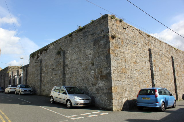
Image: © Jeff Buck Taken: 25 Sep 2015
The west corner of Beaumaris Gaol on the junction of Bunker's Hill and Gaol Street. Beaumaris Gaol was built in 1829 and closed in 1878 when it became a police station until the 1950s when it then became a children's clinic and lastly a museum in 1974. *Source: Wikipedia.
Images are licensed for reuse under creativecommons.org/licenses/by-sa/2.0
Image Location
Latitude
53.263276
Longitude
-4.095488