"Rugged Landscape", Redburn Dene
Introduction
The photograph on this page of "Rugged Landscape", Redburn Dene by Oliver Dixon as part of the Geograph project.
The Geograph project started in 2005 with the aim of publishing, organising and preserving representative images for every square kilometre of Great Britain, Ireland and the Isle of Man.

There are currently over 7.5m images from over 14,400 individuals and you can help contribute to the project by visiting https://www.geograph.org.uk
"Rugged Landscape", Redburn Dene
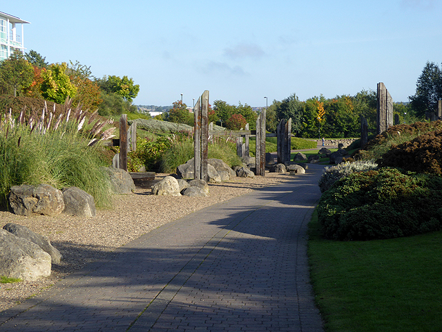
Image: © Oliver Dixon Taken: 30 Sep 2015
Originally one of the main rail corridors down to the coal staithes from the coalfields in Northumberland, the path through Redburn Dene park is now followed by National Cycle Network route 72, "Hadrians Cycleway". The large timbers used to form the carved columns were reclaimed from the nearby redundant coal staithes and along with the large boulders form the "Rugged Landscape", one of the sights along the Royal Quays Art Walk.
Images are licensed for reuse under creativecommons.org/licenses/by-sa/2.0
Image Location


Leaflet Map data © OpenStreetMap
Latitude
54.99692
Longitude
-1.460071