St Paul's Hammersmith
Introduction
The photograph on this page of St Paul's Hammersmith by Stephen McKay as part of the Geograph project.
The Geograph project started in 2005 with the aim of publishing, organising and preserving representative images for every square kilometre of Great Britain, Ireland and the Isle of Man.

There are currently over 7.5m images from over 14,400 individuals and you can help contribute to the project by visiting https://www.geograph.org.uk
St Paul's Hammersmith
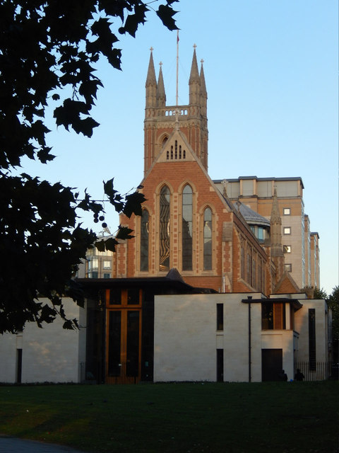
Image: © Stephen McKay Taken: 25 Sep 2015
A chapel of ease was built on this site in 1630, but the present building dates from 1882-1883 and is grade II listed. Its site is nowadays constrained by the adjacent Hammersmith flyover.
Images are licensed for reuse under creativecommons.org/licenses/by-sa/2.0
Image Location
Latitude
51.491388
Longitude
-0.225816