149-156, Snargate Street
Introduction
The photograph on this page of 149-156, Snargate Street by John Baker as part of the Geograph project.
The Geograph project started in 2005 with the aim of publishing, organising and preserving representative images for every square kilometre of Great Britain, Ireland and the Isle of Man.

There are currently over 7.5m images from over 14,400 individuals and you can help contribute to the project by visiting https://www.geograph.org.uk
149-156, Snargate Street
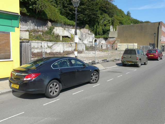
Image: © John Baker Taken: 11 Sep 2015
Compared with Image, during the intervening years the site became overgrown with buddleia bushes, but these have now been removed and also the yellow safety netting. A planning notice has been attached to the lamppost. Subsequently, Planning permission was granted by Dover District Council under application number DOV/13/00478 for an “outline application with all matters reserved for the erection of 9 dwellings”.
Images are licensed for reuse under creativecommons.org/licenses/by-sa/2.0
Image Location
Latitude
51.122437
Longitude
1.311207