Downtown Glassford
Introduction
The photograph on this page of Downtown Glassford by Richard Dorrell as part of the Geograph project.
The Geograph project started in 2005 with the aim of publishing, organising and preserving representative images for every square kilometre of Great Britain, Ireland and the Isle of Man.

There are currently over 7.5m images from over 14,400 individuals and you can help contribute to the project by visiting https://www.geograph.org.uk
Downtown Glassford
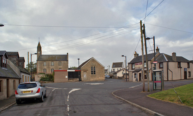
Image: © Richard Dorrell Taken: 18 Sep 2015
Viewed from Hunterlees Road, this painted roundabout road junction lies at the centre of the small village. On the right is the Glassford Inn public house, while the village hall lies straight ahead. The Parish Church, built 1820, stands on a small hill to the left.
Images are licensed for reuse under creativecommons.org/licenses/by-sa/2.0
Image Location
Latitude
55.699946
Longitude
-4.028066