Regent Hill, Brighton
Introduction
The photograph on this page of Regent Hill, Brighton by Simon Carey as part of the Geograph project.
The Geograph project started in 2005 with the aim of publishing, organising and preserving representative images for every square kilometre of Great Britain, Ireland and the Isle of Man.

There are currently over 7.5m images from over 14,400 individuals and you can help contribute to the project by visiting https://www.geograph.org.uk
Regent Hill, Brighton
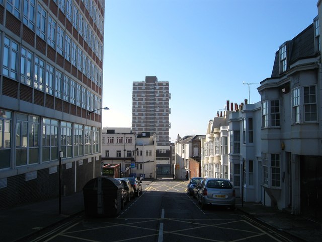
Image: © Simon Carey Taken: 20 Sep 2015
A side street linking Upper North Street to Western Road albeit a busy one as it is used by local buses which terminate outside the Imperial Arcade on Dyke Road as a loop to their starting point on Western Road. Developed in the 1820s though only the western side survives with all of the eastern side removed for the expansion of Marks & Spencer and the construction of Crown House on the immediate left. The large block of flats is Chartwell Court.
Images are licensed for reuse under creativecommons.org/licenses/by-sa/2.0
Image Location
Latitude
50.824233
Longitude
-0.146723