Canal Way plaque - London Borough of Hillingdon
Introduction
The photograph on this page of Canal Way plaque - London Borough of Hillingdon by David Hawgood as part of the Geograph project.
The Geograph project started in 2005 with the aim of publishing, organising and preserving representative images for every square kilometre of Great Britain, Ireland and the Isle of Man.

There are currently over 7.5m images from over 14,400 individuals and you can help contribute to the project by visiting https://www.geograph.org.uk
Canal Way plaque - London Borough of Hillingdon
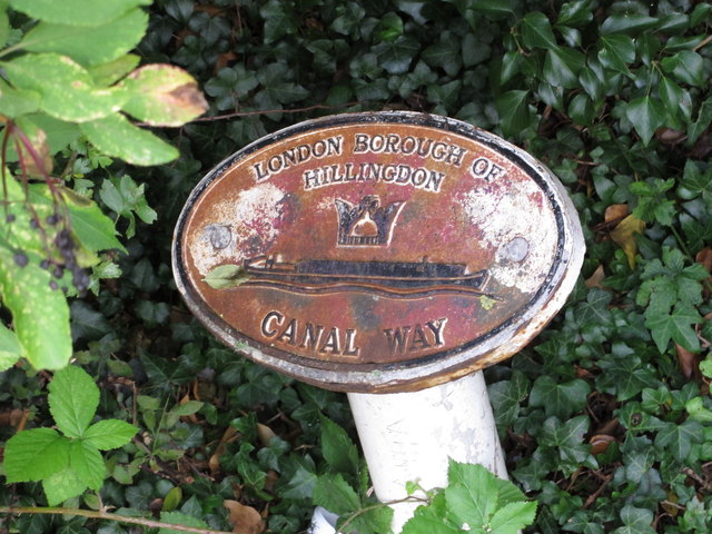
Image: © David Hawgood Taken: 17 Sep 2015
Canal Way was a project started in the 1970s by the Greater London Council to improve towpaths and make them accessible. It shares part of its logo with the 1977 Jubilee Way - the other part of the logo is a narrowboat on waves. There are many of these signs, erected by different boroughs - the londoncanals.co.uk website lists and describes them. The towpath by this plaque forms the boundary between Ealing and Hillingdon - so although the adjacent playing field is in Ealing, this plaque is on the boundary so could have either borough's name on it.
Images are licensed for reuse under creativecommons.org/licenses/by-sa/2.0
Image Location
Latitude
51.528278
Longitude
-0.376333