Site of RAF Dundonald from the air
Introduction
The photograph on this page of Site of RAF Dundonald from the air by Thomas Nugent as part of the Geograph project.
The Geograph project started in 2005 with the aim of publishing, organising and preserving representative images for every square kilometre of Great Britain, Ireland and the Isle of Man.

There are currently over 7.5m images from over 14,400 individuals and you can help contribute to the project by visiting https://www.geograph.org.uk
Site of RAF Dundonald from the air
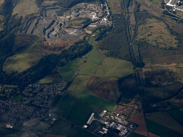
Image: © Thomas Nugent Taken: 14 Sep 2015
The faint 'X' outline of the runways of the former RAF Dundonald airfield can be seen in the grass between the industrial estate (Olympic Business Park) and the quarry. A surviving hangar building can be seen at the edge of the business park Image
Images are licensed for reuse under creativecommons.org/licenses/by-sa/2.0
Image Location
Latitude
55.586457
Longitude
-4.606827