London (Waltham Forest), 1955: Leyton, Baker's Arms intersection
Introduction
The photograph on this page of London (Waltham Forest), 1955: Leyton, Baker's Arms intersection by Ben Brooksbank as part of the Geograph project.
The Geograph project started in 2005 with the aim of publishing, organising and preserving representative images for every square kilometre of Great Britain, Ireland and the Isle of Man.

There are currently over 7.5m images from over 14,400 individuals and you can help contribute to the project by visiting https://www.geograph.org.uk
London (Waltham Forest), 1955: Leyton, Baker's Arms intersection
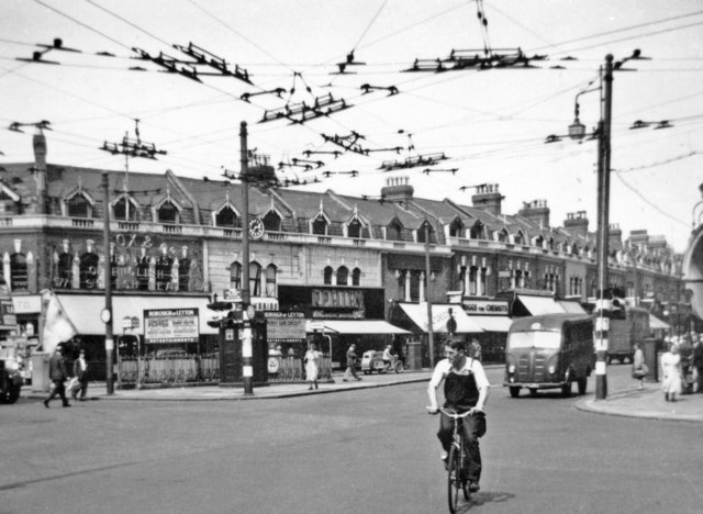
Image: © Ben Brooksbank Taken: 13 Jul 1955
With High Road, Leyton (A112) behind, we are looking across Lea Bridge Road (A104), going off to the left NE towards Walthamstow, Hoe Street. Note the forest of overhead cables, for the numerous trolley-buses operating here in those days - 60 years ago. (Cf. Image).
Images are licensed for reuse under creativecommons.org/licenses/by-sa/2.0
Image Location
Latitude
51.575291
Longitude
-0.012858