Glasgow and the Clyde from the air
Introduction
The photograph on this page of Glasgow and the Clyde from the air by Thomas Nugent as part of the Geograph project.
The Geograph project started in 2005 with the aim of publishing, organising and preserving representative images for every square kilometre of Great Britain, Ireland and the Isle of Man.

There are currently over 7.5m images from over 14,400 individuals and you can help contribute to the project by visiting https://www.geograph.org.uk
Glasgow and the Clyde from the air
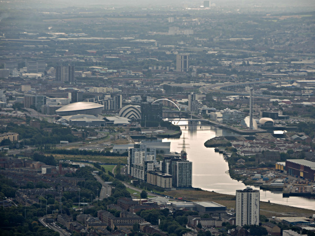
Image: © Thomas Nugent Taken: 14 Sep 2015
Curle Street towerblock Image is in the foreground. The landmark structures at the former docklands are from left to right, the Hydro Arena, the Clyde Auditorium, the Clyde Arc bridge, BBC Scotland HQ, Glasgow Science Centre and tower, Glasgow Imax cinema. The M74 Northern Extension can be seen curving in and out on the right. The large square black building at the top is the Dakota Hotel Image near Coatbridge.
Images are licensed for reuse under creativecommons.org/licenses/by-sa/2.0
Image Location
Latitude
55.872858
Longitude
-4.332322