Swainby Pinfold
Introduction
The photograph on this page of Swainby Pinfold by Mick Garratt as part of the Geograph project.
The Geograph project started in 2005 with the aim of publishing, organising and preserving representative images for every square kilometre of Great Britain, Ireland and the Isle of Man.

There are currently over 7.5m images from over 14,400 individuals and you can help contribute to the project by visiting https://www.geograph.org.uk
Swainby Pinfold
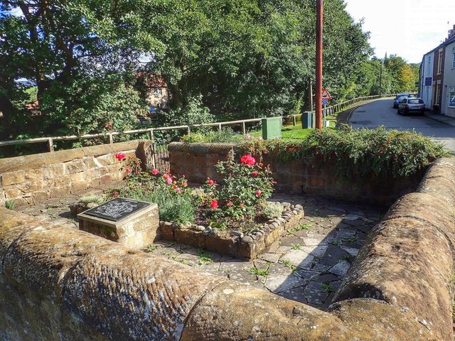
Image: © Mick Garratt Taken: 16 Sep 2015
Most villages had at one time a pinfold or pound for stray cattle, sheep or pigs where they would stay until claimed by the owner on payment of a fine. Nowadays pinfolds are no longer used and a lot have been demolished. Swainby is a quiet village at the foot of the Cleveland Hills bisected by Scugdale Beck and its pinfold has been restored as a public space for the village. From my blog: https://fhithich.wordpress.com/2015/09/16/swainby-pinfold/
Images are licensed for reuse under creativecommons.org/licenses/by-sa/2.0
Image Location
Latitude
54.413387
Longitude
-1.267606