Romsey Signal Box in its new location
Introduction
The photograph on this page of Romsey Signal Box in its new location by Alan Cooper as part of the Geograph project.
The Geograph project started in 2005 with the aim of publishing, organising and preserving representative images for every square kilometre of Great Britain, Ireland and the Isle of Man.

There are currently over 7.5m images from over 14,400 individuals and you can help contribute to the project by visiting https://www.geograph.org.uk
Romsey Signal Box in its new location
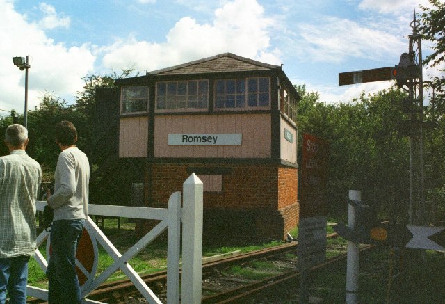
Image: © Alan Cooper Taken: 7 Aug 2005
Romsey Signal Box was built in 1871 and was originally located on the other side of the railway embankment (just visible on the left of the photo). Resignalling works in 1982 made the box redundant. When BR asked the nearby infants school for access permission to remove the box, the Headteacher had the idea of saving it for education purposes. A trust was formed and bought the box for £10. Moving it into the school grounds cost another £10,000! It is now a listed building and is looked after by The Friends of Romsey Signal Box and is open one Sunday every month. See their website: http://www.romseysignalbox.org.uk/
Images are licensed for reuse under creativecommons.org/licenses/by-sa/2.0
Image Location
Latitude
50.990892
Longitude
-1.491295