Former stables, Blackhorse Way
Introduction
The photograph on this page of Former stables, Blackhorse Way by Andy Potter as part of the Geograph project.
The Geograph project started in 2005 with the aim of publishing, organising and preserving representative images for every square kilometre of Great Britain, Ireland and the Isle of Man.

There are currently over 7.5m images from over 14,400 individuals and you can help contribute to the project by visiting https://www.geograph.org.uk
Former stables, Blackhorse Way
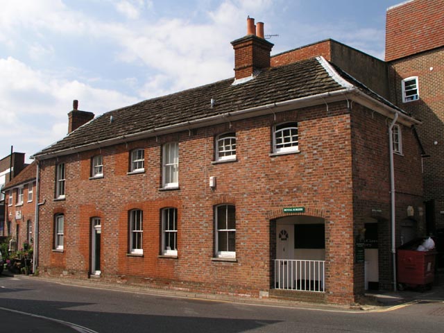
Image: © Andy Potter Taken: 24 May 2007
Formerly the stables to Image next to Image this is now home to a dental surgery. Conversion from the building's original use required modifications to windows and doors which are still visible due to the use of ill-matched bricks. Happily the open arches at the east end were retained.
Images are licensed for reuse under creativecommons.org/licenses/by-sa/2.0
Image Location


Leaflet Map data © OpenStreetMap
Latitude
51.062325
Longitude
-0.330108