The hamlet of Rhenigidale
Introduction
The photograph on this page of The hamlet of Rhenigidale by Julian Paren as part of the Geograph project.
The Geograph project started in 2005 with the aim of publishing, organising and preserving representative images for every square kilometre of Great Britain, Ireland and the Isle of Man.

There are currently over 7.5m images from over 14,400 individuals and you can help contribute to the project by visiting https://www.geograph.org.uk
The hamlet of Rhenigidale
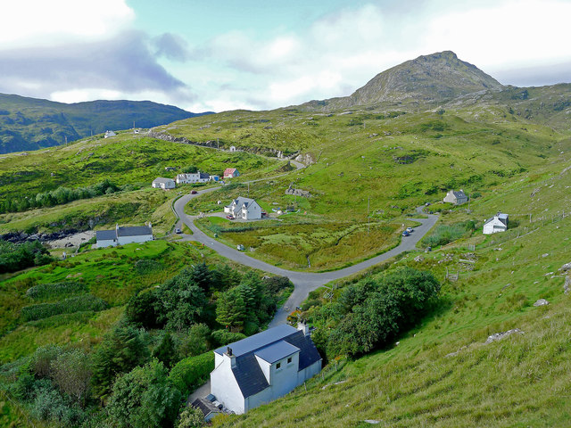
Image: © Julian Paren Taken: 6 Sep 2015
All but one of the houses of Rhenigidale are visible here. The school bus calls daily in term time and on demand in the school holidays. There is a postbox, a self catering cottage and the Gatliff Trust Youth Hostel. The Hostel Warden lives here as does the last postman who did the daily walk along the "Postman's Path" from Urgha on the Tarbert to Scalpay Road. The mountain Toddun dominates the village. The trees and road are recent additions to the village.
Images are licensed for reuse under creativecommons.org/licenses/by-sa/2.0
Image Location
Latitude
57.919098
Longitude
-6.682381