Guilden Sutton Methodist Church
Introduction
The photograph on this page of Guilden Sutton Methodist Church by David Dixon as part of the Geograph project.
The Geograph project started in 2005 with the aim of publishing, organising and preserving representative images for every square kilometre of Great Britain, Ireland and the Isle of Man.

There are currently over 7.5m images from over 14,400 individuals and you can help contribute to the project by visiting https://www.geograph.org.uk
Guilden Sutton Methodist Church
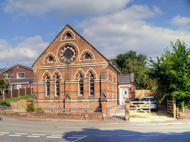
Image: © David Dixon Taken: 7 Sep 2015
The Primitive Methodist Chapel opened in 1873 (Image]) and was closed sometime after 2010 (http://goo.gl/drlMfQ Chester Chronicle). It appears to have been converted into residential accommodation.
Images are licensed for reuse under creativecommons.org/licenses/by-sa/2.0
Image Location
Latitude
53.209347
Longitude
-2.826023