Moorhouse to Laxton (aerial 2015)
Introduction
The photograph on this page of Moorhouse to Laxton (aerial 2015) by Chris as part of the Geograph project.
The Geograph project started in 2005 with the aim of publishing, organising and preserving representative images for every square kilometre of Great Britain, Ireland and the Isle of Man.

There are currently over 7.5m images from over 14,400 individuals and you can help contribute to the project by visiting https://www.geograph.org.uk
Moorhouse to Laxton (aerial 2015)
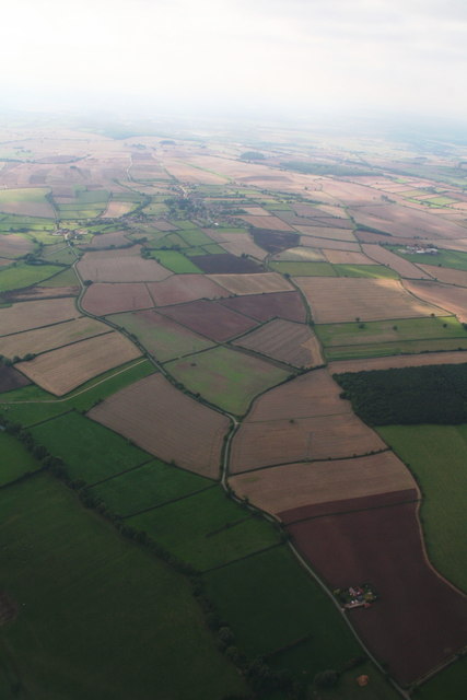
Image: © Chris Taken: 7 Sep 2015
Laxton is famous as the last place where the medieval system of open field farming is still practised, managed by a Manorial Court with powers to determine legal proceedings and levy fines. The court appoints a Jury which inspects the wheat field annually to ensure the three field crop rotation system is adhered to and which recommends fines for transgressions noted, which are brought to the court the following week to be heard. In the early years of the 20th century the ancient strips were partially enclosed and strips combined into larger strips. The remaining strips are still farmed by tenants of the Crown Estate. The strips are specified in each tenancy and each farmer farms his own. Moorhouse Beck runs across the left corner, with Laxton's South Field to the left of it. Moorhouse was once known as Moorhouse in the Bog. With thanks to Joy Allison for the text. See http://www.laxtonnotts.org.uk/ ; http://www.laxtonvisitorcentre.org.uk/ ; www.openfield.org.uk ; www.laxtonhistorygroup.org.uk and http://bibliodyssey.blogspot.co.uk/2007/12/laxton-open-field-survey-map.html See also aerial shots in Image, Image, Image, Image and Image
Images are licensed for reuse under creativecommons.org/licenses/by-sa/2.0
Image Location
Latitude
53.189352
Longitude
-0.891712