Former stable block, Killerton
Introduction
The photograph on this page of Former stable block, Killerton by Derek Harper as part of the Geograph project.
The Geograph project started in 2005 with the aim of publishing, organising and preserving representative images for every square kilometre of Great Britain, Ireland and the Isle of Man.

There are currently over 7.5m images from over 14,400 individuals and you can help contribute to the project by visiting https://www.geograph.org.uk
Former stable block, Killerton
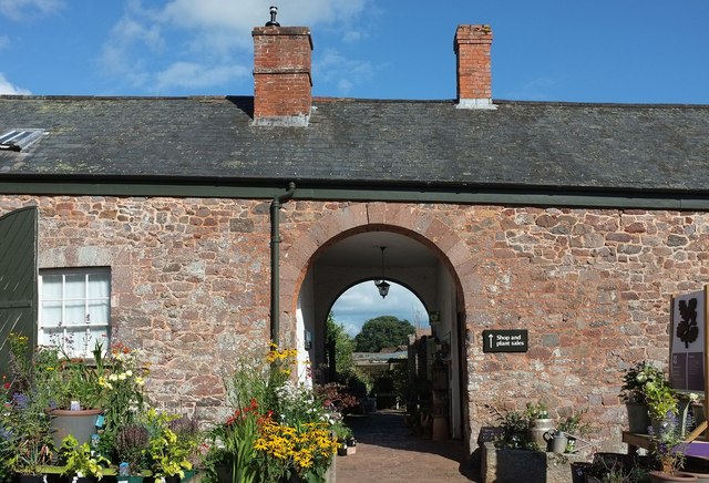
Image: © Derek Harper Taken: 2 Sep 2015
The eastern side of the quadrangle http://list.historicengland.org.uk/resultsingle.aspx?uid=1170665&searchtype=mapsearch , which dates from 1778. The archway is the third, minor, entrance. The other side of this range can be seen in Image
Images are licensed for reuse under creativecommons.org/licenses/by-sa/2.0
Image Location
Latitude
50.791308
Longitude
-3.453744