Former Drill Hall - Southfield Street
Introduction
The photograph on this page of Former Drill Hall - Southfield Street by John M as part of the Geograph project.
The Geograph project started in 2005 with the aim of publishing, organising and preserving representative images for every square kilometre of Great Britain, Ireland and the Isle of Man.

There are currently over 7.5m images from over 14,400 individuals and you can help contribute to the project by visiting https://www.geograph.org.uk
Former Drill Hall - Southfield Street
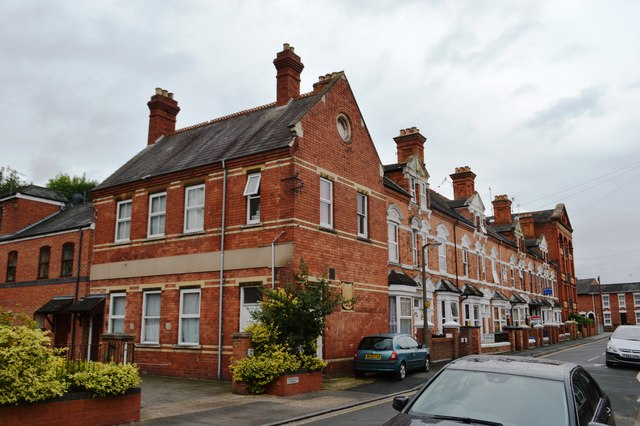
Image: © John M Taken: 5 Sep 2015
This building and terrace appear on the 1904 mapping but not on the 1887 version. The building in the foreground appears to be associated with the drill hall complex completing the range of pre-1887 buildings on two sides of a courtyard. A blank shield on the gable end offers no clues to function. The earlier buildings have been replaced by housing though opposite boundary wall still has a series of tethering rings for horses.
Images are licensed for reuse under creativecommons.org/licenses/by-sa/2.0
Image Location
Latitude
52.196902
Longitude
-2.218386