Kames Institute
Introduction
The photograph on this page of Kames Institute by Mary and Angus Hogg as part of the Geograph project.
The Geograph project started in 2005 with the aim of publishing, organising and preserving representative images for every square kilometre of Great Britain, Ireland and the Isle of Man.

There are currently over 7.5m images from over 14,400 individuals and you can help contribute to the project by visiting https://www.geograph.org.uk
Kames Institute
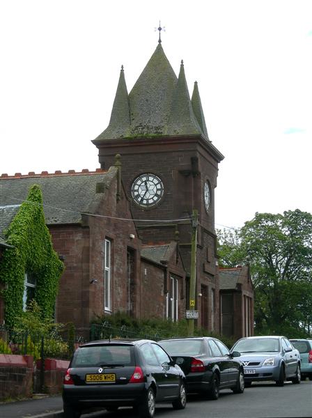
Image: © Mary and Angus Hogg Taken: 10 Jun 2007
The former Ironworks Institute was erected in 1904 as a community resource for the miners. It had a billiard room, library and reading room, function hall, games room and ancillary facilities. The Institute was later closed and, for a number of years, the building was used as an outdoor activity centre. (Source: "The River Ayr Way", by Dane Love)
Images are licensed for reuse under creativecommons.org/licenses/by-sa/2.0
Image Location
Latitude
55.51416
Longitude
-4.066806