
The eastern slope of Heversham Head
Introduction
The photograph on this page of The eastern slope of Heversham Head by Karl and Ali as part of the Geograph project.
The Geograph project started in 2005 with the aim of publishing, organising and preserving representative images for every square kilometre of Great Britain, Ireland and the Isle of Man.

There are currently over 7.5m images from over 14,400 individuals and you can help contribute to the project by visiting https://www.geograph.org.uk
The eastern slope of Heversham Head
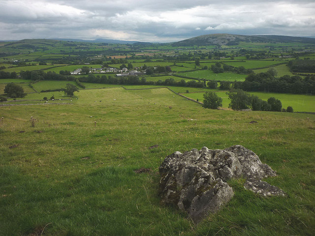
Image: © Karl and Ali Taken: 31 Aug 2015
An isolated limestone hill north of Heversham, the area has many similarities to the Arnside Silverdale AONB just to the south but without the protection that designation brings (hence the new telecoms mast?). Nevertheless, it is well worth anyone's time and small amount of effort to explore, particularly if you want to dodge the Bank Holiday hordes. Looking east, Farleton Knott is prominent with Ingleborough in the distance.
Images are licensed for reuse under creativecommons.org/licenses/by-sa/2.0
Image Location

Latitude
54.247372
Longitude
-2.763759