Development site, 70-74 Dufferin Avenue, Bangor (September 2015)
Introduction
The photograph on this page of Development site, 70-74 Dufferin Avenue, Bangor (September 2015) by Albert Bridge as part of the Geograph project.
The Geograph project started in 2005 with the aim of publishing, organising and preserving representative images for every square kilometre of Great Britain, Ireland and the Isle of Man.

There are currently over 7.5m images from over 14,400 individuals and you can help contribute to the project by visiting https://www.geograph.org.uk
Development site, 70-74 Dufferin Avenue, Bangor (September 2015)
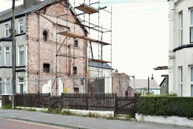
Image: © Albert Bridge Taken: 1 Sep 2015
The properties have been demolished leaving this gap. There is the following planning permission “W/2014/0343/F 70-74 Dufferin Avenue Bangor Demolition of existing 3 no. terraced dwellings, Residential Development consisting of 11 no. 1 bed apartments including on-site parking and the partial re-surfacing of an access lane to the rear. (amended description).” The elevations available on the NI Planning Portal show a building similar in style to the surrounding houses. This photograph appears as a matter of record only. I have no connection with the developer and cannot enter into correspondence.
Images are licensed for reuse under creativecommons.org/licenses/by-sa/2.0
Image Location
Latitude
54.660221
Longitude
-5.673001