153-155, High Street, Lindfield
Introduction
The photograph on this page of 153-155, High Street, Lindfield by Simon Carey as part of the Geograph project.
The Geograph project started in 2005 with the aim of publishing, organising and preserving representative images for every square kilometre of Great Britain, Ireland and the Isle of Man.

There are currently over 7.5m images from over 14,400 individuals and you can help contribute to the project by visiting https://www.geograph.org.uk
153-155, High Street, Lindfield
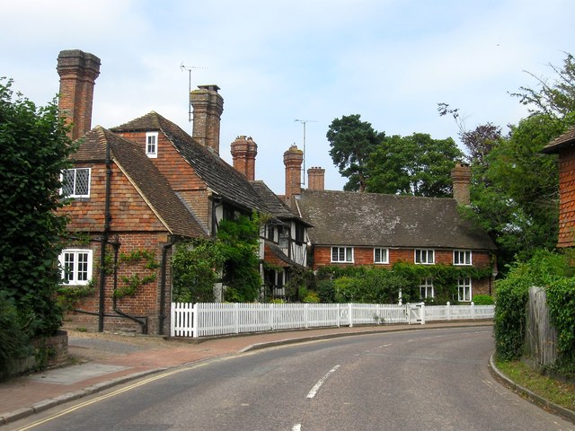
Image: © Simon Carey Taken: 30 Aug 2015
Known locally as Pretty Corner and containing the timber framed number 153 on the left, also known as Little Blacklands, which dates from the 15th century, and straight ahead 155, also known as Firs Cottage which was built in the 17th. Both were restored during the 20th century. To the right is a brief glimpse of Image whilst the drive to the left leads to Image, Image and Image
Images are licensed for reuse under creativecommons.org/licenses/by-sa/2.0
Image Location


Leaflet Map data © OpenStreetMap
Latitude
51.016847
Longitude
-0.07846