The Thatched Cottage, High Street, Lindfield
Introduction
The photograph on this page of The Thatched Cottage, High Street, Lindfield by Simon Carey as part of the Geograph project.
The Geograph project started in 2005 with the aim of publishing, organising and preserving representative images for every square kilometre of Great Britain, Ireland and the Isle of Man.

There are currently over 7.5m images from over 14,400 individuals and you can help contribute to the project by visiting https://www.geograph.org.uk
The Thatched Cottage, High Street, Lindfield
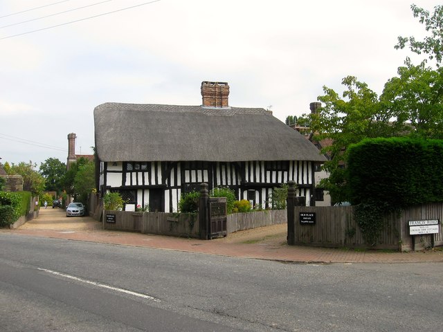
Image: © Simon Carey Taken: 30 Aug 2015
A Wealden hall house dating from the early 15th century and occasionally as far back as 1390. Originally the main house of the local Chaloner family prior to their building Image next door in 1590. Beyond Image on the eastern side the houses cease being numbered and become known by their names.
Images are licensed for reuse under creativecommons.org/licenses/by-sa/2.0
Image Location
Latitude
51.016653
Longitude
-0.077613