Sowerby Bridge FP99
Introduction
The photograph on this page of Sowerby Bridge FP99 by Humphrey Bolton as part of the Geograph project.
The Geograph project started in 2005 with the aim of publishing, organising and preserving representative images for every square kilometre of Great Britain, Ireland and the Isle of Man.

There are currently over 7.5m images from over 14,400 individuals and you can help contribute to the project by visiting https://www.geograph.org.uk
Sowerby Bridge FP99
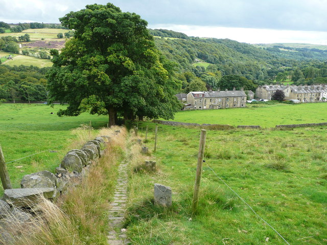
Image: © Humphrey Bolton Taken: 29 Aug 2015
This view is from near the top of the path at The Breck, looking down towards the A58. The path is paved with stone setts, partly covered by grass, and is flanked by stone fence posts, most of which are broken.
Images are licensed for reuse under creativecommons.org/licenses/by-sa/2.0
Image Location
Latitude
53.699459
Longitude
-1.934985