South end of Drayton Park station (1)
Introduction
The photograph on this page of South end of Drayton Park station (1) by Richard Vince as part of the Geograph project.
The Geograph project started in 2005 with the aim of publishing, organising and preserving representative images for every square kilometre of Great Britain, Ireland and the Isle of Man.

There are currently over 7.5m images from over 14,400 individuals and you can help contribute to the project by visiting https://www.geograph.org.uk
South end of Drayton Park station (1)
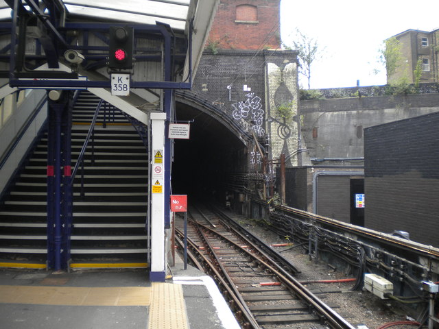
Image: © Richard Vince Taken: 16 Jul 2015
Looking south, towards Moorgate, from the south end of platform 2. The railway is underground from here to the terminus at Moorgate. As clearance in the tunnels is insufficient for overhead electrification, the lines through them are electrified on the 750V DC third rail system, Drayton Park station being the changeover point between that and 25kV 50Hz AC overhead electrification.
Images are licensed for reuse under creativecommons.org/licenses/by-sa/2.0
Image Location
Latitude
51.552547
Longitude
-0.105735