Harbour heights looking toward Seaford Head
Introduction
The photograph on this page of Harbour heights looking toward Seaford Head by Simon Carey as part of the Geograph project.
The Geograph project started in 2005 with the aim of publishing, organising and preserving representative images for every square kilometre of Great Britain, Ireland and the Isle of Man.

There are currently over 7.5m images from over 14,400 individuals and you can help contribute to the project by visiting https://www.geograph.org.uk
Harbour heights looking toward Seaford Head
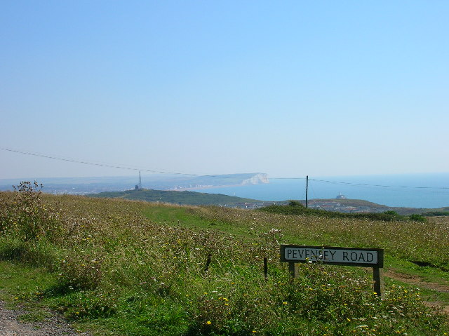
Image: © Simon Carey Taken: 30 Aug 2005
The high ground between the town of Peacehaven and port of Newhaven contains gorse, scrubland, unmade roads, caravan parks and houses erected before the age of tough planning laws. This view was taken from the junction of Charleston Avenue and Pevensey Road. On the cliff top to the left is the coastguard lookout and radio mast, that to the right a small lighthouse. Beyond them is Seaford Bay, the far eastern end of Seaford and the clifftop of Seaford Head.
Images are licensed for reuse under creativecommons.org/licenses/by-sa/2.0
Image Location
Latitude
50.785471
Longitude
0.031494