Sign for the Spring Rock Inn, Greetland
Introduction
The photograph on this page of Sign for the Spring Rock Inn, Greetland by Stephen Craven as part of the Geograph project.
The Geograph project started in 2005 with the aim of publishing, organising and preserving representative images for every square kilometre of Great Britain, Ireland and the Isle of Man.

There are currently over 7.5m images from over 14,400 individuals and you can help contribute to the project by visiting https://www.geograph.org.uk
Sign for the Spring Rock Inn, Greetland
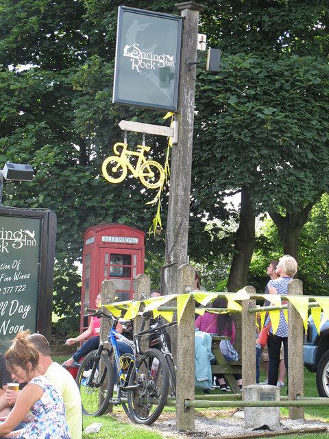
Image: © Stephen Craven Taken: 6 Jul 2014
For the pub itself, see Image The yellow bike and bunting were for the Tour de France that had come past earlier in the day. The small stone surrounded by a railing at the bottom of the photo is a Fundamental benchmark, one of the key points in the original Ordnance Survey of England.
Images are licensed for reuse under creativecommons.org/licenses/by-sa/2.0
Image Location


Leaflet Map data © OpenStreetMap
Latitude
53.686852
Longitude
-1.900481