Old pump, Little Wakering
Introduction
The photograph on this page of Old pump, Little Wakering by Robin Webster as part of the Geograph project.
The Geograph project started in 2005 with the aim of publishing, organising and preserving representative images for every square kilometre of Great Britain, Ireland and the Isle of Man.

There are currently over 7.5m images from over 14,400 individuals and you can help contribute to the project by visiting https://www.geograph.org.uk
Old pump, Little Wakering
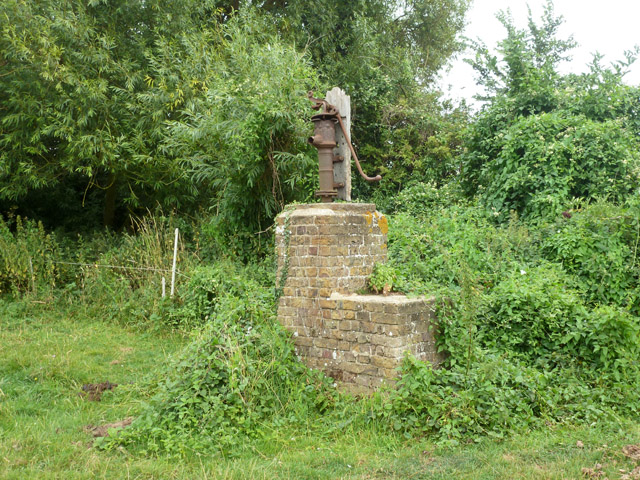
Image: © Robin Webster Taken: 11 Aug 2015
In a field belonging to Little Wakering Wick, its elevated position is unusual. There is no evidence the brickwork was part of a larger building on old maps. The location was first noted on maps as a well. Perhaps the idea was to protect the well from flooding.
Images are licensed for reuse under creativecommons.org/licenses/by-sa/2.0
Image Location
Latitude
51.561374
Longitude
0.793299