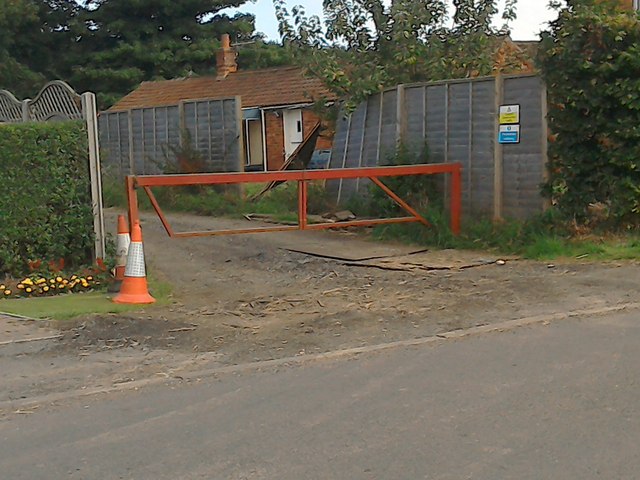
Fulstow's footpath 91- or should be
Introduction
The photograph on this page of Fulstow's footpath 91- or should be by Chris as part of the Geograph project.
The Geograph project started in 2005 with the aim of publishing, organising and preserving representative images for every square kilometre of Great Britain, Ireland and the Isle of Man.
There are currently over 7.5m images from over 14,400 individuals and you can help contribute to the project by visiting https://www.geograph.org.uk

Image: © Chris Taken: 16 Aug 2015
With the Ramblers' Pathwatch scheme underway, and its free GPS software, it's a great opportunity to catch up on some dubious paths, and try and get the Lincs County Council to sort the problem. When you hit a problem area you wonder if you've got it wrong, but with the GPS and the arrow on the post there is little doubt where the path should run. This lane now leads to a construction site. The blue sign reads "Pedestrian Walkway" but the barrier suggests otherwise. You can squeeze round the left end by trampling on the neighbour's flower bed. Unfortunately that is not the end of the problem. There are no direction signs or arrows anywhere. On my second visit I potted another of the blue signs behind a jungle of weeds and scrub. I persevered, beat my way through the next hedge, only to be stopped by an unbridged drain. I turned back, intending to reroute via Footpath 90. No signs. When I returned for a 2nd visit I spotted a faded arrow on the back only of a post, in line with a rotten stile (top bar hanging off) buried in weeds and brambles. Hence two unusable paths, and one of the only other three paths out of Fulstow is barred by an enormous drain, and the Council says no chance of a bridge in the near future owing to cuts in funding. Such is the state of many of our local paths, though the favoured few are neatly mown, which is nice, but I would prefer they spent what money they have on keeping the paths open rather than all the nice mowing. I wonder if the Pathwatch scheme can make a difference, but I'm not holding my breath. See also Image], Image] and Image

