Fire Ground demonstration
Introduction
The photograph on this page of Fire Ground demonstration by Richard Croft as part of the Geograph project.
The Geograph project started in 2005 with the aim of publishing, organising and preserving representative images for every square kilometre of Great Britain, Ireland and the Isle of Man.

There are currently over 7.5m images from over 14,400 individuals and you can help contribute to the project by visiting https://www.geograph.org.uk
Fire Ground demonstration
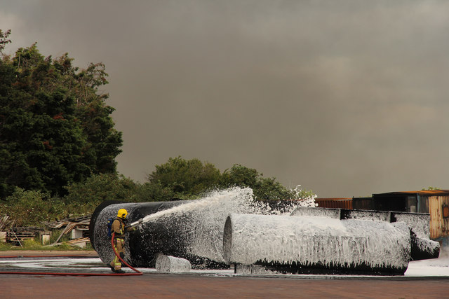
Image: © Richard Croft Taken: 14 Aug 2015
Around three minutes after the dramatic inferno of an aviation fuel fire http://www.geograph.org.uk/photo/4616041 Graduates of RAF Recruit Firefighter Course 01-15 have everything under control at the Defence Fire Training and Development Centre, Manston https://www.gov.uk/government/publications/defence-fire-training-and-development-centre/defence-fire-training-and-development-centre
Images are licensed for reuse under creativecommons.org/licenses/by-sa/2.0
Image Location


Leaflet Map data © OpenStreetMap
Latitude
51.354211
Longitude
1.350171