Chapel Cottage, Sea Lane, Sandilands
Introduction
The photograph on this page of Chapel Cottage, Sea Lane, Sandilands by DAVID BAILEY as part of the Geograph project.
The Geograph project started in 2005 with the aim of publishing, organising and preserving representative images for every square kilometre of Great Britain, Ireland and the Isle of Man.

There are currently over 7.5m images from over 14,400 individuals and you can help contribute to the project by visiting https://www.geograph.org.uk
Chapel Cottage, Sea Lane, Sandilands
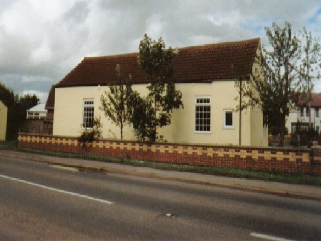
Image: © DAVID BAILEY Taken: Unknown
Situated on the triangle at the start of sea lane/A52 junction, the old Methodist chapel until c.1900, when it was converted to a home. I lived there from 1996 to 2002.
Images are licensed for reuse under creativecommons.org/licenses/by-sa/2.0
Image Location
Latitude
53.299187
Longitude
0.284769