St Etheldreda, White Notley
Introduction
The photograph on this page of St Etheldreda, White Notley by Bikeboy as part of the Geograph project.
The Geograph project started in 2005 with the aim of publishing, organising and preserving representative images for every square kilometre of Great Britain, Ireland and the Isle of Man.

There are currently over 7.5m images from over 14,400 individuals and you can help contribute to the project by visiting https://www.geograph.org.uk
St Etheldreda, White Notley
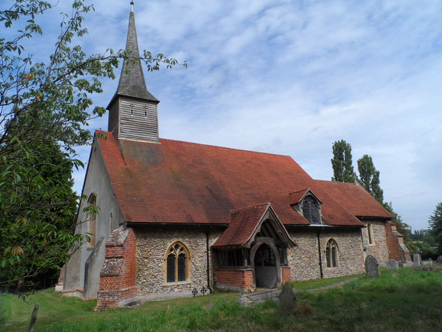
Image: © Bikeboy Taken: 11 Aug 2015
The chancel and nave were built in C11. Originally the chancel ended in an apse but this was squared off in C13. The south aisle was also added in C13. The north aisle is C19 and it may have been built on the site of an earlier chapel. The belfry was added in C16.
Images are licensed for reuse under creativecommons.org/licenses/by-sa/2.0
Image Location


Leaflet Map data © OpenStreetMap
Latitude
51.834051
Longitude
0.589865