The Square and Compasses-which year?
Introduction
The photograph on this page of The Square and Compasses-which year? by Bikeboy as part of the Geograph project.
The Geograph project started in 2005 with the aim of publishing, organising and preserving representative images for every square kilometre of Great Britain, Ireland and the Isle of Man.

There are currently over 7.5m images from over 14,400 individuals and you can help contribute to the project by visiting https://www.geograph.org.uk
The Square and Compasses-which year?
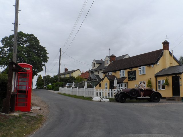
Image: © Bikeboy Taken: 11 Aug 2015
I know it's 2015 but perhaps the vintage car might seem to make it older. It must be post 1935 (I think the phone box is a K6 (see https://en.wikipedia.org/wiki/Red_telephone_box#K1). The lettering on the pub is obviously fairly modern. The TV aerials date it (probably within a window of 1950-2025), the power lines? the woman's clothes ? Unfortunately the Chelsea tractor hidden a few doors down give it away- and the plastic window frames look very modern.
Images are licensed for reuse under creativecommons.org/licenses/by-sa/2.0
Image Location


Leaflet Map data © OpenStreetMap
Latitude
51.815581
Longitude
0.533667