Meaford Road Lock near Stone, Staffordshire
Introduction
The photograph on this page of Meaford Road Lock near Stone, Staffordshire by Roger D Kidd as part of the Geograph project.
The Geograph project started in 2005 with the aim of publishing, organising and preserving representative images for every square kilometre of Great Britain, Ireland and the Isle of Man.

There are currently over 7.5m images from over 14,400 individuals and you can help contribute to the project by visiting https://www.geograph.org.uk
Meaford Road Lock near Stone, Staffordshire
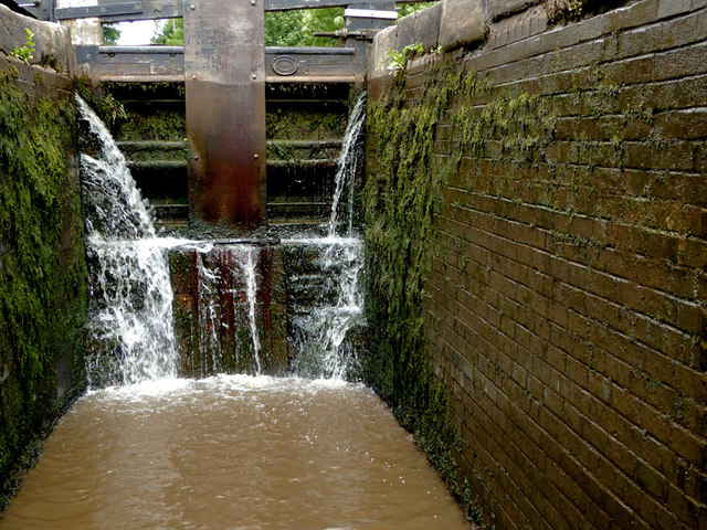
Image: © Roger D Kidd Taken: 3 Aug 2015
This is the top gate of Meaford Road Lock (No 33) seen from in the lock chamber when it was empty. The four locks in the Meaford flight provide a rise of 32ft 5in (just under ten metres). This is the third one up.
Images are licensed for reuse under creativecommons.org/licenses/by-sa/2.0
Image Location
Latitude
52.917168
Longitude
-2.163252