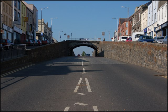
The Cut, Banbridge
Introduction
The photograph on this page of The Cut, Banbridge by Albert Bridge as part of the Geograph project.
The Geograph project started in 2005 with the aim of publishing, organising and preserving representative images for every square kilometre of Great Britain, Ireland and the Isle of Man.
There are currently over 7.5m images from over 14,400 individuals and you can help contribute to the project by visiting https://www.geograph.org.uk

Image: © Albert Bridge Taken: 9 Jun 2007
The Cut through the centre of Banbridge was completed in 1834 in response to the needs of the mail coaches which found the streets through the town too steep. It is 200 yards long and 15 feet deep. Bridge Street is in the foreground and Newry Street is out of sight in the dip. Rathfriland Street is to the left of the top of the bridge and Scarva Street to the right. The bridge is officially the “Downshire Bridge” but is commonly known as the “Jinglers Bridge” from the sound of the change jingled by 19th century market traders who used it to sell their wares. To go back a few years see Image

