St. Andrew's Church, Julian Rd.
Introduction
The photograph on this page of St. Andrew's Church, Julian Rd. by HelenK as part of the Geograph project.
The Geograph project started in 2005 with the aim of publishing, organising and preserving representative images for every square kilometre of Great Britain, Ireland and the Isle of Man.

There are currently over 7.5m images from over 14,400 individuals and you can help contribute to the project by visiting https://www.geograph.org.uk
St. Andrew's Church, Julian Rd.
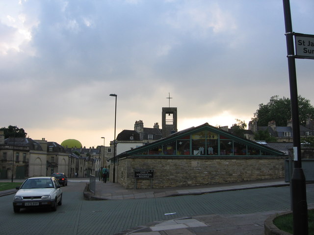
Image: © HelenK Taken: 8 Jun 2007
St Andrew's is a replacement for a church of the same name which once stood on the other side of Julian Road but was bombed in the Second World War. The green road surface shows this is a 'shared space' between road users and pedestrians, one of a handful of such schemes in Britain. A hot-air balloon is just about to go up.
Images are licensed for reuse under creativecommons.org/licenses/by-sa/2.0
Image Location
Latitude
51.388323
Longitude
-2.368282