Aerial View of Wytham Abbey and All Saints Church, Oxfordshire
Introduction
The photograph on this page of Aerial View of Wytham Abbey and All Saints Church, Oxfordshire by Dave Price as part of the Geograph project.
The Geograph project started in 2005 with the aim of publishing, organising and preserving representative images for every square kilometre of Great Britain, Ireland and the Isle of Man.

There are currently over 7.5m images from over 14,400 individuals and you can help contribute to the project by visiting https://www.geograph.org.uk
Aerial View of Wytham Abbey and All Saints Church, Oxfordshire
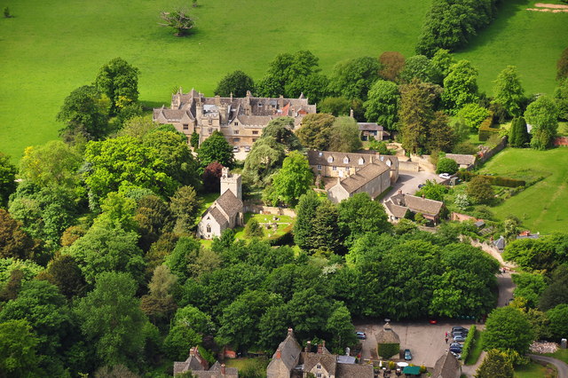
Image: © Dave Price Taken: 2 Jun 2013
Taken from a paramotor. In the near foreground can be seen a dovecote in the carpark of the White Hart Public House. More information about Wytham can be found on the village's website http://www.wytham-village.org.uk/ . Image
Images are licensed for reuse under creativecommons.org/licenses/by-sa/2.0
Image Location
Latitude
51.773616
Longitude
-1.313411