Demolition site, Dover Road
Introduction
The photograph on this page of Demolition site, Dover Road by John Baker as part of the Geograph project.
The Geograph project started in 2005 with the aim of publishing, organising and preserving representative images for every square kilometre of Great Britain, Ireland and the Isle of Man.

There are currently over 7.5m images from over 14,400 individuals and you can help contribute to the project by visiting https://www.geograph.org.uk
Demolition site, Dover Road
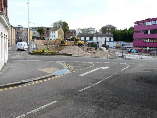
Image: © John Baker Taken: 3 Jul 2015
Compared with Image but viewed from Foord Road South and therefore showing more of the site to the right. Folkestone and Hythe District Council did not raise an objection under application number Y14/1173/SH for the “prior notification of proposed demolition of 28-38 Dover Road and 83-85 Tontine Street”. This view will soon disappear behind hoarding, which is in the process of being erected.
Images are licensed for reuse under creativecommons.org/licenses/by-sa/2.0
Image Location
Latitude
51.082235
Longitude
1.181519