Rock face detail
Introduction
The photograph on this page of Rock face detail by Lairich Rig as part of the Geograph project.
The Geograph project started in 2005 with the aim of publishing, organising and preserving representative images for every square kilometre of Great Britain, Ireland and the Isle of Man.

There are currently over 7.5m images from over 14,400 individuals and you can help contribute to the project by visiting https://www.geograph.org.uk
Rock face detail
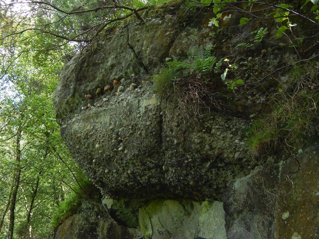
Image: © Lairich Rig Taken: 15 Jul 2015
This is a closer view of the feature shown in Image and, from the other side, in Image; the line of the rock exposure is marked on large-scale mapping. The pebbles that can be seen here are mostly quartz, rounded by water, and this upper part of the exposure is probably an example of the Douglas Muir Quartz-Conglomerate (DMQ), whose type locality is nearby Douglas Muir Quarry (not far to the north-east, at Image – see the map). DMQ is a member of the Lawmuir Formation. DMQ is said to rest apparently unconformably on volcaniclastic sediments of the Kirkwood Formation (KRW); geological maps show that formation in this area, and it most probably makes up the lower parts of this rock exposure.
Images are licensed for reuse under creativecommons.org/licenses/by-sa/2.0
Image Location
Latitude
55.934684
Longitude
-4.384392