Pillbox at Inner Elm Terrace
Introduction
The photograph on this page of Pillbox at Inner Elm Terrace by Phil Williams as part of the Geograph project.
The Geograph project started in 2005 with the aim of publishing, organising and preserving representative images for every square kilometre of Great Britain, Ireland and the Isle of Man.

There are currently over 7.5m images from over 14,400 individuals and you can help contribute to the project by visiting https://www.geograph.org.uk
Pillbox at Inner Elm Terrace
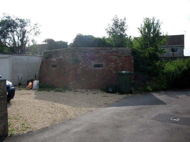
Image: © Phil Williams Taken: 7 Jun 2007
A view looking to the west towards a pillbox at the western end of Inner Elm Terrace. Until recently, this was largely covered by an overgrowth of brambles. The right-hand wall of the box is still blackened by the fire that removed the overgrowth. This box formed part of the defensive perimeter for Norton Hill Colliery.
Images are licensed for reuse under creativecommons.org/licenses/by-sa/2.0
Image Location
Latitude
51.285086
Longitude
-2.471699