"The Town Inn", Hatfield New Town
Introduction
The photograph on this page of "The Town Inn", Hatfield New Town by Jim Osley as part of the Geograph project.
The Geograph project started in 2005 with the aim of publishing, organising and preserving representative images for every square kilometre of Great Britain, Ireland and the Isle of Man.

There are currently over 7.5m images from over 14,400 individuals and you can help contribute to the project by visiting https://www.geograph.org.uk
"The Town Inn", Hatfield New Town
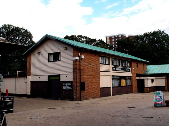
Image: © Jim Osley Taken: 27 Jul 2015
In 1948 Hatfield was designated a new town and a new town centre was built according to a master plan devised by Lionel Brett (Lord Esher). The design of the public house is very typical of 1950s new town architect. Once no doubt full of optimism, the centre of Hatfield is a depressed area with a number a shop units closed and having a desultory air about it.
Images are licensed for reuse under creativecommons.org/licenses/by-sa/2.0
Image Location
Latitude
51.76622
Longitude
-0.241539