High Wycombe railway station
Introduction
The photograph on this page of High Wycombe railway station by Nigel Cox as part of the Geograph project.
The Geograph project started in 2005 with the aim of publishing, organising and preserving representative images for every square kilometre of Great Britain, Ireland and the Isle of Man.

There are currently over 7.5m images from over 14,400 individuals and you can help contribute to the project by visiting https://www.geograph.org.uk
High Wycombe railway station
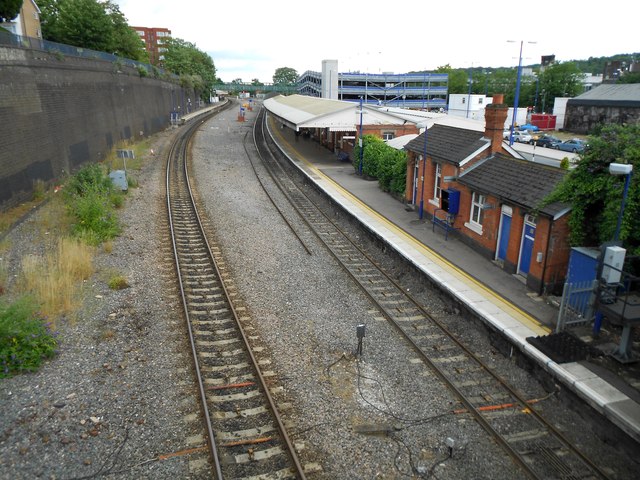
Image: © Nigel Cox Taken: 25 Jul 2015
This is the view from the A404 Amersham Hill/Crendon Street road bridge. Please compare with the same views taken in 2007 and 2013 Image and Image As is evident there used to be four lines through here, with two through non-stop tracks. The up platform in the distance is unusually by some way divorced from the down one on the right.
Images are licensed for reuse under creativecommons.org/licenses/by-sa/2.0
Image Location
Latitude
51.629835
Longitude
-0.746198