Sundial, Robinson Almshouses.
Introduction
The photograph on this page of Sundial, Robinson Almshouses. by Gordon Hatton as part of the Geograph project.
The Geograph project started in 2005 with the aim of publishing, organising and preserving representative images for every square kilometre of Great Britain, Ireland and the Isle of Man.

There are currently over 7.5m images from over 14,400 individuals and you can help contribute to the project by visiting https://www.geograph.org.uk
Sundial, Robinson Almshouses.
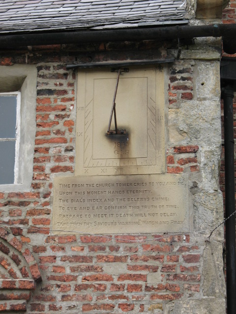
Image: © Gordon Hatton Taken: 7 Jun 2007
The sundial has a suitably serious text carved below.
Images are licensed for reuse under creativecommons.org/licenses/by-sa/2.0
Image Location


Leaflet Map data © OpenStreetMap
Latitude
54.259479
Longitude
-1.529001