St. Paul's Church, Wightman Road / Cavendish Road, N4
Introduction
The photograph on this page of St. Paul's Church, Wightman Road / Cavendish Road, N4 by Mike Quinn as part of the Geograph project.
The Geograph project started in 2005 with the aim of publishing, organising and preserving representative images for every square kilometre of Great Britain, Ireland and the Isle of Man.

There are currently over 7.5m images from over 14,400 individuals and you can help contribute to the project by visiting https://www.geograph.org.uk
St. Paul's Church, Wightman Road / Cavendish Road, N4
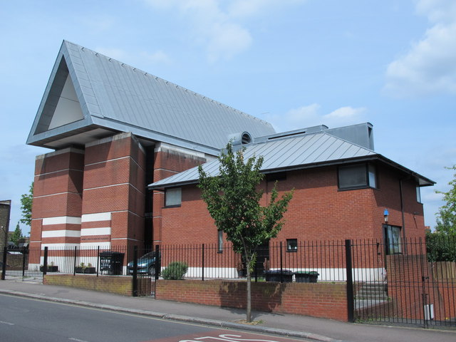
Image: © Mike Quinn Taken: 18 Jun 2015
In 1984 the original late-19th C church building on this site was destroyed by fire. The current building, designed by London architects Peter Inskipp and Peter Jenkins, was opened in 1993 https://en.wikipedia.org/wiki/St_Paul%27s_Church,_Harringay .
Images are licensed for reuse under creativecommons.org/licenses/by-sa/2.0
Image Location


Leaflet Map data © OpenStreetMap
Latitude
51.578241
Longitude
-0.104233