Steps leading down to Iain Road
Introduction
The photograph on this page of Steps leading down to Iain Road by Lairich Rig as part of the Geograph project.
The Geograph project started in 2005 with the aim of publishing, organising and preserving representative images for every square kilometre of Great Britain, Ireland and the Isle of Man.

There are currently over 7.5m images from over 14,400 individuals and you can help contribute to the project by visiting https://www.geograph.org.uk
Steps leading down to Iain Road
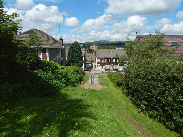
Image: © Lairich Rig Taken: 3 Jul 2015
These steps lead out of the western end of Roman Park, and down to Iain Road, part of which is visible ahead. Close to the point from which this picture was taken, the line of the Antonine Wall changes direction, as the map shows. The Wall heads west towards this point (compare Image), but then turns to head north-west for a distance of about 250 metres before resuming a more westerly course. This flight of steps is on the line of the Wall, and is on the same SE-NW alignment, so, as well as being a view down the steps, this picture is a view along the line of this part (built over with housing) of the Antonine Wall. For a view back up the steps, see Image
Images are licensed for reuse under creativecommons.org/licenses/by-sa/2.0
Image Location
Latitude
55.922842
Longitude
-4.350531