149, High Street, Lindfield
Introduction
The photograph on this page of 149, High Street, Lindfield by Simon Carey as part of the Geograph project.
The Geograph project started in 2005 with the aim of publishing, organising and preserving representative images for every square kilometre of Great Britain, Ireland and the Isle of Man.

There are currently over 7.5m images from over 14,400 individuals and you can help contribute to the project by visiting https://www.geograph.org.uk
149, High Street, Lindfield
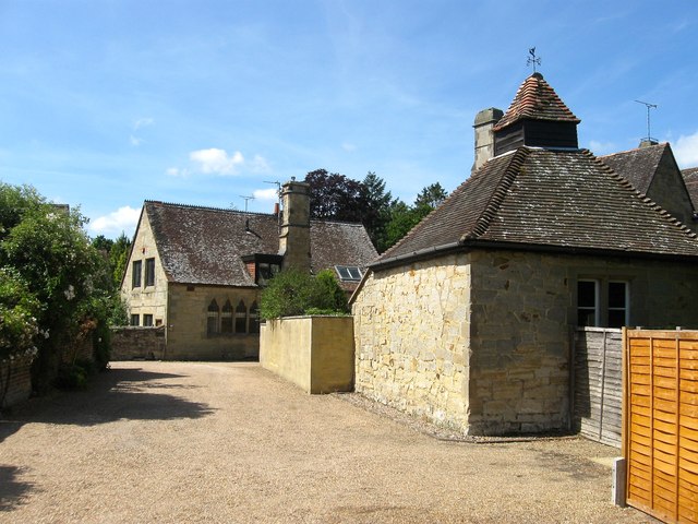
Image: © Simon Carey Taken: 18 Jul 2015
Set back from the High Street the imposing sandstone building is one of two dwellings that occupy what was originally a school built by the local vicar during the mid 19th century. After the vicar's death the parish decided against keeping it and was sold to the County Towns Mission who remained here until 1937 when they sold it back to the parish. The former Mission Hall was subdivided and is now three residences, see Image See also, Image
Images are licensed for reuse under creativecommons.org/licenses/by-sa/2.0
Image Location
Latitude
51.016768
Longitude
-0.079176