Ruins of the 'old' church, Treyford
Introduction
The photograph on this page of Ruins of the 'old' church, Treyford by Stefan Czapski as part of the Geograph project.
The Geograph project started in 2005 with the aim of publishing, organising and preserving representative images for every square kilometre of Great Britain, Ireland and the Isle of Man.

There are currently over 7.5m images from over 14,400 individuals and you can help contribute to the project by visiting https://www.geograph.org.uk
Ruins of the 'old' church, Treyford
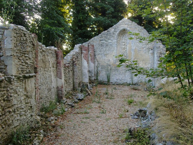
Image: © Stefan Czapski Taken: 19 Jul 2015
View from the chancel towards the blocked west window. According to a notice at the site, much of the surviving fabric dates from the 13th century. It seems that the church was abandoned in 1849, being replaced by a new church about a quarter of a mile to the north-west. The new church itself lasted little more than a century, being deemed unsafe in 1951 and blown up. To use explosives to demolish a church sounds a bit drastic - perhaps the job was done by local men who had wartime experience as sappers.
Images are licensed for reuse under creativecommons.org/licenses/by-sa/2.0
Image Location
Latitude
50.961659
Longitude
-0.827775