Hopton Heath station
Introduction
The photograph on this page of Hopton Heath station by John Winder as part of the Geograph project.
The Geograph project started in 2005 with the aim of publishing, organising and preserving representative images for every square kilometre of Great Britain, Ireland and the Isle of Man.

There are currently over 7.5m images from over 14,400 individuals and you can help contribute to the project by visiting https://www.geograph.org.uk
Hopton Heath station
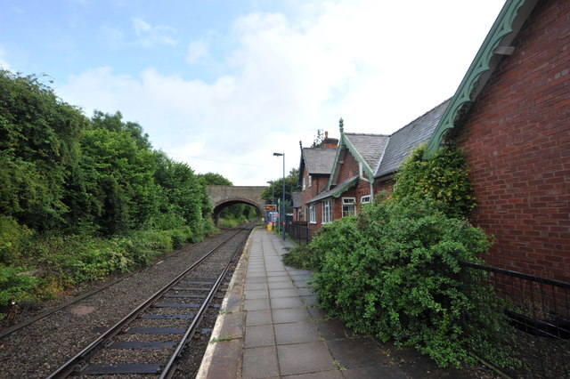
Image: © John Winder Taken: 12 Jul 2015
Until recently, Hopton Heath was the least - used national rail network station in Shropshire, although now that dubious honour falls to Broome station which is just up the line. The Heart of Wales Line, which this is, was originally built as double track but has now been singled: careful scrutiny of the left hand side of the shot should reveal the stonework of the former Shrewsbury platform peeping through the undergrowth. The station building is now two private houses. A small hut next to the bridge at the end of the platform provides shelter for the many passengers who throng to the station every day.
Images are licensed for reuse under creativecommons.org/licenses/by-sa/2.0
Image Location
Latitude
52.391369
Longitude
-2.912059