Temporary closure of the level crossing
Introduction
The photograph on this page of Temporary closure of the level crossing by John Baker as part of the Geograph project.
The Geograph project started in 2005 with the aim of publishing, organising and preserving representative images for every square kilometre of Great Britain, Ireland and the Isle of Man.

There are currently over 7.5m images from over 14,400 individuals and you can help contribute to the project by visiting https://www.geograph.org.uk
Temporary closure of the level crossing
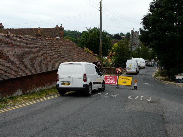
Image: © John Baker Taken: 28 Jun 2015
This was to enable the laying of new track between the platforms of Chartham station from 01.55 on 28/06/15 to 04:30 on 29/06/15. The tops of the machinery being used can be seen to the left of the white vans. If one followed the diversion signs along the A28, one had proceed as far as Shamsford Bridge Image, turn left into Shamsford Street and left again into Bolts Hill, which then took one along Parish Road to The Green. For customers wishing to use the railway, there was a bus-replacement service, along the A28, reached by crossing the railway line by means of the station’s footbridge.
Images are licensed for reuse under creativecommons.org/licenses/by-sa/2.0
Image Location
Latitude
51.257662
Longitude
1.017592