The Parish Church of St Paul, Farington Moss
Introduction
The photograph on this page of The Parish Church of St Paul, Farington Moss by David Dixon as part of the Geograph project.
The Geograph project started in 2005 with the aim of publishing, organising and preserving representative images for every square kilometre of Great Britain, Ireland and the Isle of Man.

There are currently over 7.5m images from over 14,400 individuals and you can help contribute to the project by visiting https://www.geograph.org.uk
The Parish Church of St Paul, Farington Moss
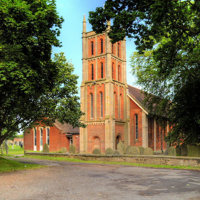
Image: © David Dixon Taken: 12 Jul 2015
St Paul's Church is in the village of Farington Moss. The church designated as a Grade II listed building (English Heritage Building ID: 357913 http://www.britishlistedbuildings.co.uk/en-357913-church-of-st-paul-farington-lancashire#.VajERnnbKHs British Listed Buildings). St Paul's was built in 1839–40 and it is an example of a Commissioners’ Church built with money voted by Parliament as a result of the Church Building Act of 1818 and 1824 (http://en.wikipedia.org/wiki/Commissioners%27_church ). The church is built in brick with stone dressings and a red tile roof. The tower and nave are in Romanesque style and the chancel is in Gothic Revival style. Its plan consists of a six-bay nave, a chancel, and a northwest tower. The tower has four stages, with angle buttresses rising to a pinnacle at each corner. In the bottom stage are arched doorways; above this each stage contains a pair of round-headed windows. The windows in the first floor are glazed; those above are louvred. When first built it had seating for 479 people. It was enlarged in 1909 by adding an extra bay to the nave and increasing the size of the chancel. https://en.wikipedia.org/wiki/St_Paul%27s_Church,_Farington Wikipedia
Images are licensed for reuse under creativecommons.org/licenses/by-sa/2.0
Image Location
Latitude
53.719982
Longitude
-2.701431